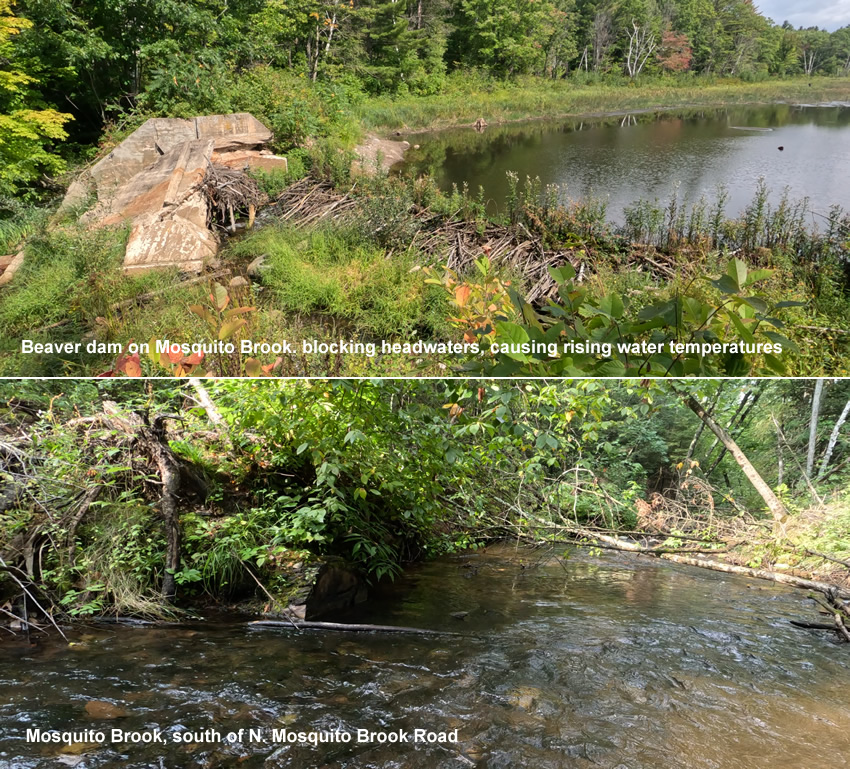

About Mosquito Brook
In northwestern Wisconsin’s Sawyer County, Mosquito Brook starts at a large spring pond complex surrounded by high quality wetlands over 200 acres in size. The Brook then runs into another spring pond approximately 35 acres in size before starting its five-mile journey to the confluence with the Namekagon River. The Namekagon is itself a 24-mile-long tributary to the St. Croix River. In 1968, 200 miles of the St. Croix National Scenic Riverway, which includes its major tributary the Namekagon, was established as one of the original eight rivers under the Wild and Scenic Rivers Act. The Namekagon River and its tributaries have been identified by the Wisconsin State Council of Trout Unlimited in its Priority Waters Plan.
All but the last half mile of Mosquito Brook is bordered by the Sawyer County Forest, which buffers the watershed from the effects of human caused degradation. The Wisconsin Department of Natural Resources has labeled Mosquito Brook a Class 1 trout stream – meaning it holds self-sustaining populations of trout and no stocking is occurring in the watershed. DNR fish surveys have shown Mosquito Brook to be a cold-water refuge during summer months for larger trout in the Namekagon River system. It also holds good numbers of young-of-the-year fish. Click here to view a map of Mosquito Brook.

Why Mosquito Brook?
The purpose of our Mosquito Brook Watershed Baseline Project is to improve the scientific understanding of the stream function and to start building support for this important cold-water resource in the local community. One objective of the Project will be to gain insights into the water quality and thermal regime through macroinvertebrate and temperature monitoring at 6 sites within the watershed.
Another objective of the Project will be to gain a better understanding of how trout are using the stream for spawning purposes. Fish sampling with minnow traps in the headwaters will supplement existing WDNR trout surveys downstream.
Wild, native brook trout, and wild naturalized brown trout are both present and appear to be doing well as of 2024. But climate studies project a statewide 67% loss of brook trout habitat and a 30% loss of brown trout habitat due to climate effects over the next 50 years. The over-arching goal is to manage the watershed so that trout continue to sustain a meaningful presence in this system. We already know, or strongly suspect that multiple and complex issues are in play, and deserving of further study and action, including but not limited to: groundwater conservancy; wetland restoration, forest carbon sequestration; run-off, genetics, dams and barriers, wildlife (especially waterfowl, deer, and beaver): human use and development.
The WRTU Chapter will benefit from the Project by partnering with students at the local tribal university to do GIS mapping and by engaging middle school students at the Northern Waters Environmental School for stream monitoring activities resulting in approximately 120 student volunteer hours. Achieving these conservation and TU chapter strengthening objectives will allow Wild Rivers TU to start working on the long-term goal of creating a Watershed Plan to help conserve wild, self-sustaining trout populations in Mosquito Brook through this century.
